Historical and archival materials were the primary data sources for the research on the Mamula fortifications, conducted by the expert team at the PROJEKTOR Conservation Studio in Tivat from 2015 to 2016. Alongside local archives, crucial documentation was sourced from archives in Split, Zadar, and Pula (Croatia) and from the War Archive within the Austrian State Archives (*Das Österreichische Staatsarchiv – Vienna Kriegsarchiv*). The following text highlights key documents pertaining to the history of the Mamula fortress.
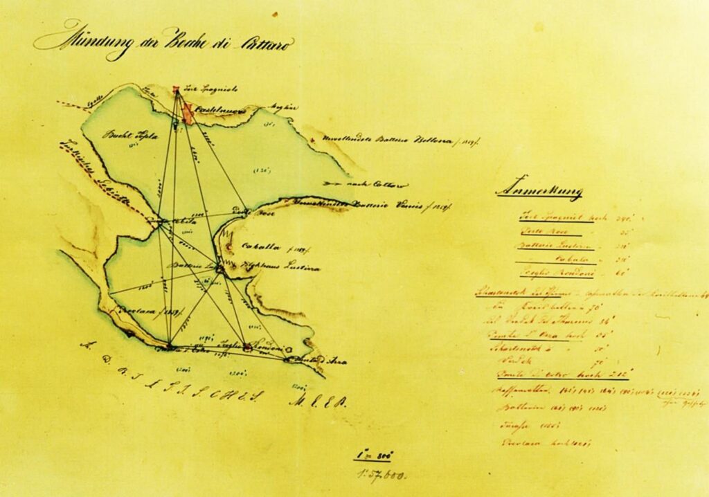
This document is part of the *Inland C-III* collection from the Cattaro War Archives in Vienna, dating to the mid-19th century. It consists of a large-format (~A0) map rendered in black and red ink, depicting the Topla Bay with marked locations of Austro-Hungarian fortresses and other military installations, along with the distances and lines of communication between them.
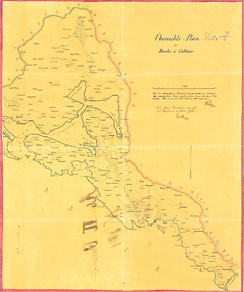
Another document, numbered 27 within the *Inland C-III* collection, was created in 1875 on similarly large (~A0) paper and utilises black, red, and blue ink. This map shows the strategic positions of all Austro-Hungarian fortifications across the Boka Bay, Grbalj, Paštrovići, and extending to the Albanian border.
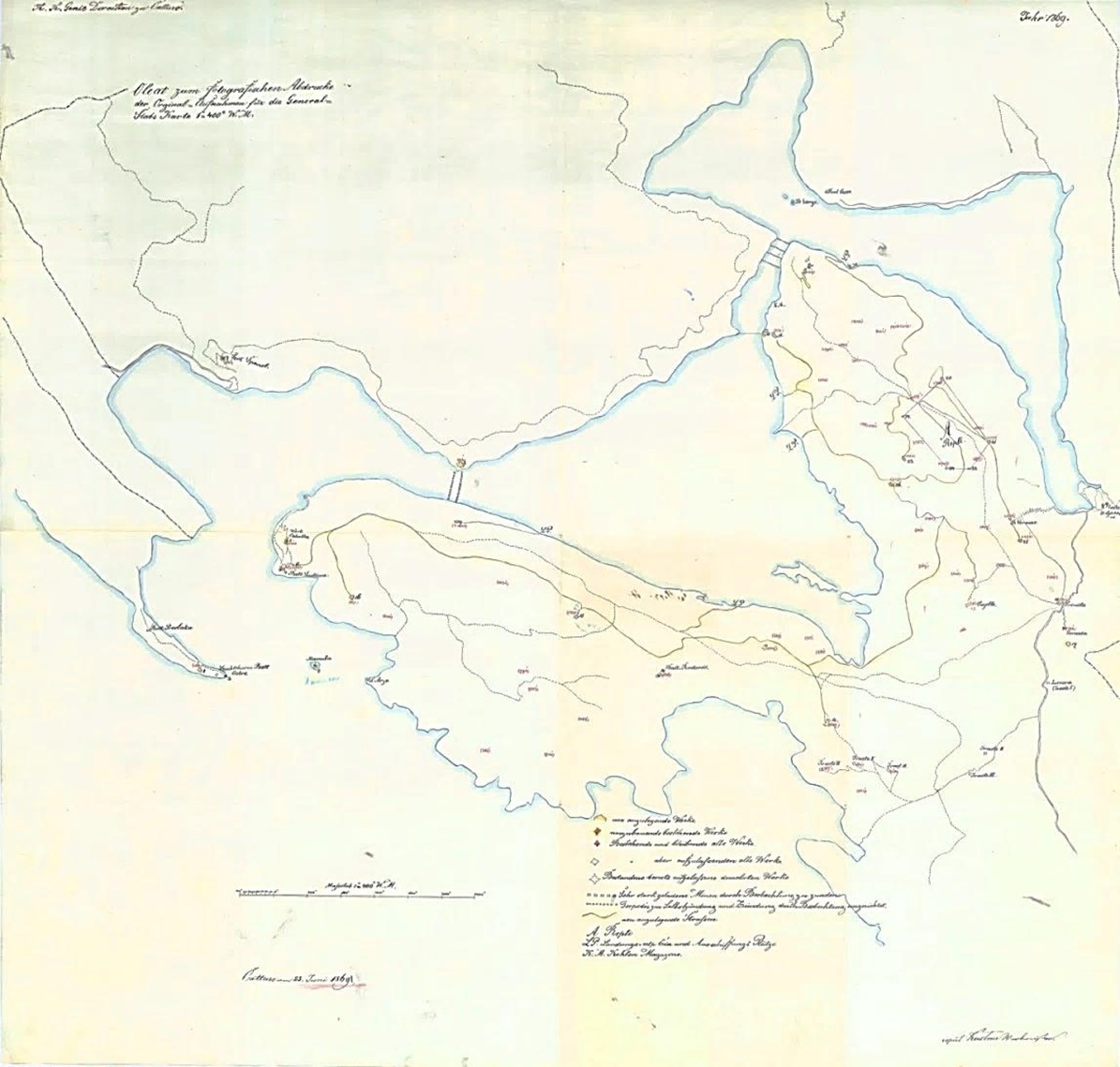
This document, numbered 26, is part of the *Inland C-III Cattaro* collection within the War Archives in Vienna and is dated 25 June 1869. It is a large-format (~A0) map on tracing paper, drawn in black, red, and blue ink. The map details the Boka Bay, illustrating all Austro-Hungarian fortifications and positions, along with a plan for interventions on each structure.
A legend at the bottom specifies proposed actions for each site, including
- complete reconstruction,
- maintenance of the current state,
- retention with enhancement, and
- complete removal.
The map also marks locations in the bay for torpedo stations and minefields. This document is especially valuable, as it includes chronological data on individual fortifications and positions, offering insights into the development and strategic planning of Austro-Hungarian defences in the area.
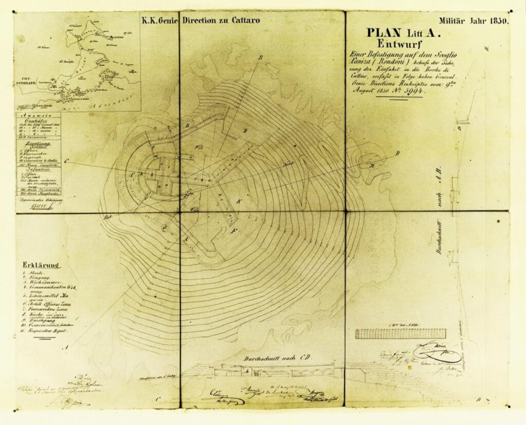
The next document, labelled *1850 Plan Litt A. Entwurf,* is part of the KVIII 69 E, Cattaro collection, dated 9 August 1850. Its purpose is somewhat ambiguous; it may represent a preliminary design for a yet-to-be-constructed fortification on the island, or it could depict an existing structure prior to Mamula’s construction in 1850. The plan includes the island’s geodetic base with fortifications, a wharf, an access path, and both cross-sectional and longitudinal views of the building. In the upper left corner, a map of the Boka Bay marks key strategic locations. The document details the proposed structure, specifying accommodation for 260 military personnel and estimating construction costs at 175,000 forints.
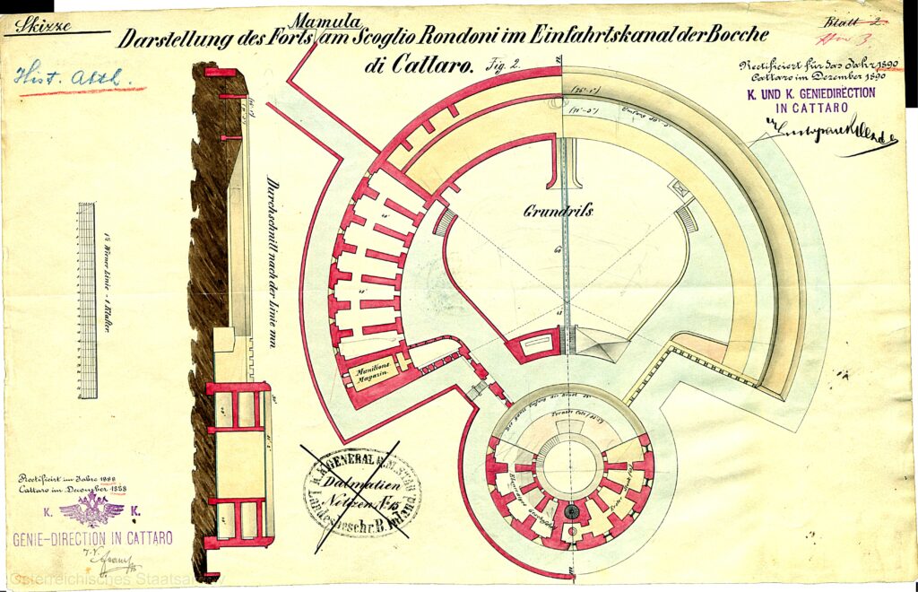
This document is part of the *Inland CIII* collection from the Castelnuovo War Archive in Vienna and was drawn up in Kotor in December 1888. The floorplans of the ground and first floors of the Mamula fortress are shown, along with a longitudinal section of the structure. The floorplans are depicted in detail, while the cross-section is shown schematically, omitting bastions and facades. Dimensions are given in clafters. This is the only document discovered so far that captures the original state of the Mamula fort before the 1880s modernisation, when it was modernised and the Merzer battery was installed.
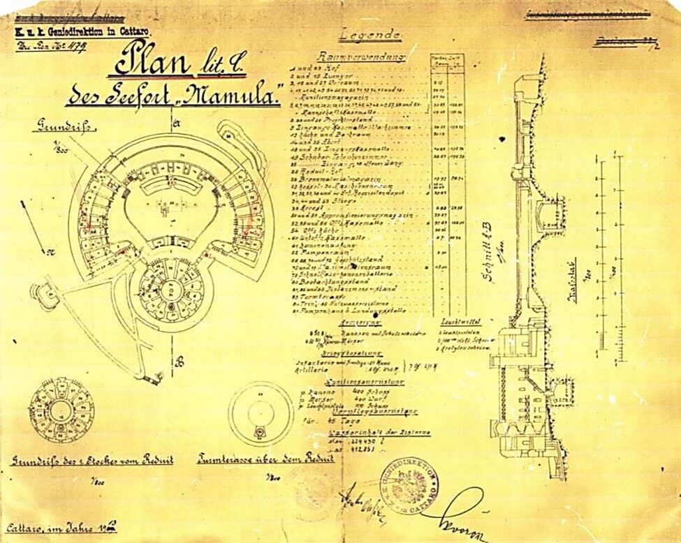
This document is highly significant as it is a technical drawing of the fortification at scales of 1:800 and 1:400. It includes the fort’s layout, observation posts, pier, access path, three foundational structures of the circular tower, and a longitudinal section with details of water cisterns and their capacities, as well as the names of all rooms within the fortress
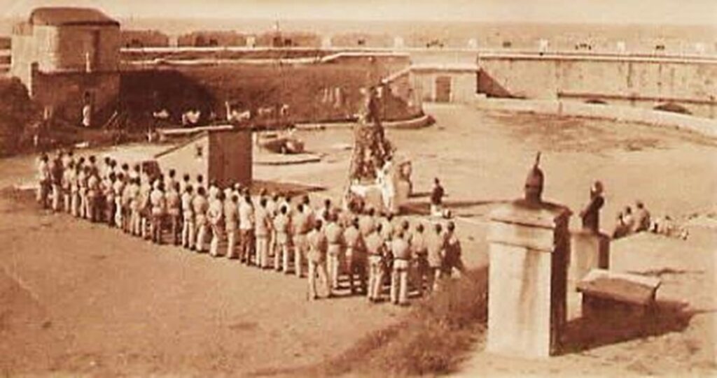
The accompanying photographs provide further historical value, illustrating the appearance and condition of the Mamula fortress from the early 20th century. The first photograph, taken during Christmas Mass in 1916, shows the fort’s condition and the number of soldiers stationed there at the time.
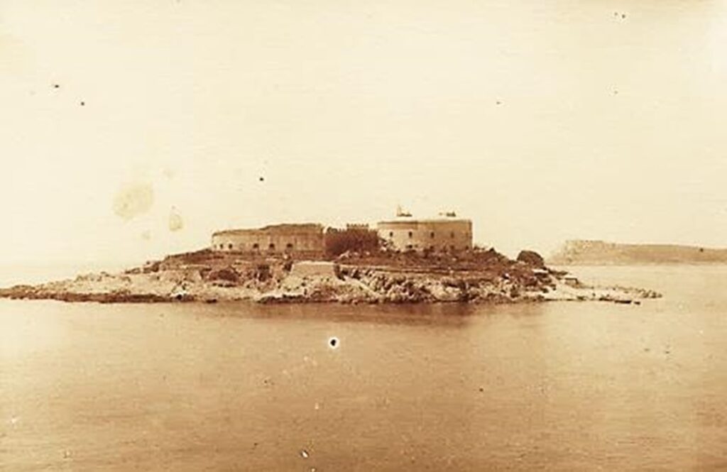
The second photograph, taken from the sea, reveals the northeast side of the island, where the fortification is clearly visible, with no vegetation obscuring its structures.